OLC at the 20th Annual Indiana Bat Festival

The 20th Annual Indiana Bat Festival at Indiana State University was all about celebrating bats—and having fun while learning about them! Ouabache Land Conservancy was thrilled to be part of the festivities with a booth designed to engage kids and families.

Our bat-themed coloring pages kept little hands busy and sparked conversations about these fascinating creatures. Families stopped by to color, ask questions, and take home information about how OLC protects land (and wildlife) here in west-central Indiana.

From crafts to live bat demonstrations, the festival offers something for everyone. We loved being part of this family-friendly tradition and sharing in the excitement of discovery and play!

Walking the Walk: Trail Work at Green's Bluff

At Ouabache Land Conservancy, our commitment to land doesn’t stop at our own preserves. We’re proud to be part of a larger community of people and organizations working to care for Indiana’s natural areas.

Board member Denise Marie Sobieski recently joined The Nature Conservancy and the Hoosier Hikers Council to blaze new trails at Green’s Bluff Nature Preserve. Boots on the ground, Denise spent the day helping to create pathways that will connect more people to nature.

This kind of work matters. It’s sweaty, sometimes thorny, often quiet—but every mile of trail creates new opportunities for families, hikers, and explorers to discover Indiana’s wild beauty.

OLC is proud to walk the walk alongside our friends in conservation. Whether it’s protecting prairies here in west-central Indiana or pitching in statewide, our volunteers and board members are part of a bigger movement to ensure nature thrives for future generations.

Learning Through Play at Explore Wabashiki

This year’s Explore Wabashiki event was a chance for Ouabache Land Conservancy to connect with neighbors, celebrate nature, and share our mission with the wider community.

Board President Alysa Morley and board members Bill Mitchell and Dan Bradley helped set up, tear down, and staff our booth—along with other dedicated volunteers. From answering questions about local conservation to sharing how people can get involved, we enjoyed meaningful conversations with visitors of all ages.

We also made sure our table wasn’t just informational—it was interactive. Guests tested their observation skills in our “guess how many” game with native Baptisia seeds and seed pods, and tried their hand at identifying local flora through our native plant photo quiz. Both activities were designed to spark curiosity, start conversations, and highlight the biodiversity we’re working to protect.

Events like Explore Wabashiki remind us that conservation isn’t only about protecting land—it’s also about helping people discover, understand, and appreciate the natural world right in their own backyard.

Tracing the Future of Plants Along the Wabash: Rich Hull’s Research at Atherton Island

Rich Hull with OLC board member Jim Nardi

A Journey Into the Wabash River Corridor

When most people look at the woods and prairies along the Wabash River, they see a landscape shaped by water, time, and history. For Rich Hull, a doctoral student at Indiana University, those same landscapes are a living archive — a place where the shifting distribution of plants tells the story of climate change, invasive species, and the resilience of Indiana’s ecosystems.

Hull began his research nearly five years ago, eventually reaching out to the Ouabache Land Conservancy (OLC) for access to its preserves. His additional work at Atherton Island Natural Area (AINA) has been especially valuable, giving OLC a clearer picture of the land it is protecting. With the data Hull has gathered, OLC will be able to track plant species at the site over time and better understand changes in biodiversity. Both Atherton Island and the Jackson-Schnyder Nature Preserve are now part of Hull’s larger survey, which spans the Wabash River corridor from Tippecanoe County in the north to Posey County in the south.

Although connected in spirit, Hull’s project at Atherton Island is separate from his dissertation research. At AINA, his goal was to create a tool for OLC, a baseline list of plant species that can be revisited in the future to monitor shifts in biodiversity. This list was generated primarily through visual observations. By contrast, the sites included in his dissertation involved a more rigorous method: Hull collected and preserved physical specimens of every species he recorded. In total, he gathered more than 13,000 plant specimens, creating a permanent record of each species’ exact location. This collection not only ensures that identifications can be verified or corrected later, but also allows for adjustments as taxonomic concepts evolve, for example, when species are split into separate classifications or lumped together.

A Researcher’s Calling

Hull’s journey into botany began early. “By the time I was in 10th grade, I knew I wanted to work outside. I thought I’d become a wildlife biologist, but as I started documenting plants, I realized just how much was missing from the record,” Hull stated. In high school, he cataloged species in his home county in Georgia, a project that grew in college into formal research on fireflies and vascular plants. “That really hooked me. Plants are the foundation of everything else, from insects to birds to mammals. If we don’t understand what’s happening to plants, we don’t understand what’s happening to ecosystems,” Hull explained.

The Wabash River: A Corridor of Diversity

Hull chose the Wabash River Corridor for its unique ecological importance. Though only 10 counties are included in his study, they contain nearly 70 percent of Indiana’s native plants ever recorded in natural environments. “The Wabash packs an incredible amount of plant diversity into a relatively narrow stretch of land. It’s one of the best places to study how species adapt to climate change, because the corridor provides a natural pathway for northward migration,” Hull explained.

Two major biomes, the Eastern deciduous forest and the tallgrass prairie, have historically converged along the river, creating transition zones like oak savannas and barrens. The corridor also carries with it wide swings in climate: southern plants follow the Mississippi and Ohio rivers northward into Indiana, while northern species drift down from the Great Lakes.

What the Data Reveals

At the heart of Hull’s project is a comparison between modern field surveys and historic records, particularly those collected a century ago by botanist Charles Deam. Deam’s approach was to collect one specimen per species per county. That gave us a broad map of where plants existed, but it wasn’t site-specific like modern surveys. Reconciling county-level records with precise site surveys is a challenge, but it lets us see broader shifts in species presence and distribution,” Hull explained.

The results so far are striking. Invasive species are common in landscapes where they were once absent. Some native plants, considered “weedy” but resilient, are moving north faster than expected. A handful of rare species may be shifting out of their historical ranges altogether.

“Seeing plants move north within just 100 years is remarkable. Normally, that would take much longer without human-driven climate change,” Hull stated.

Why Seasonal Surveys Matter

Documenting Atherton Island requires more than one visit a year. “If you miss a few weeks, you miss a whole group of plants. Spring ephemerals bloom and disappear quickly, sedges fruit for only two to four weeks, and oaks can only be properly identified when they’re dropping acorns in the fall,” Hull explained.

By visiting multiple times throughout the growing season, Hull can capture a more complete picture of the preserve’s biodiversity. In summer, sedges distinguish themselves. In the fall, asters, Indiana’s most prominent plant family, and oaks dominate the landscape. “Each trip fills another piece of the ecological puzzle,” Hull said.

Why It Matters to Everyone

For those who live far from nature, the loss of a plant species may feel distant. Hull argues otherwise. Plants are the foundation of terrestrial life. They provide food, shelter, and habitat for everything from insects to birds. They drive pollination, which underpins our crops. If we start losing native plants, we lose the building blocks of the ecosystems that sustain us,” Hull explained. Hull adds that there is also a heritage element at stake. “These species are part of our natural history. Preserving them means preserving something that defines Indiana and the Wabash Valley,” Hull exclaimed.

Lessons for Future Botanists

While passion for plants is essential, Hull emphasizes that modern botany requires broader skills. “Writing, statistics, coding, those are just as important. You can love plants, but if you can’t analyze the data or communicate it, the work doesn’t reach the people who need it,” Hull explained.  Although the number of professional botanists has declined compared to past generations, Hull believes that this opens new opportunities. “There aren’t as many botanists as there used to be, but the need is just as strong. That makes the work rewarding and urgent,” Hull explained. 

Looking Ahead

Hull’s dissertation will ultimately consist of at least three published chapters: a section of one is partially published in the Proceedings of the Indiana Academy of Science, updating county plant records; another comparing surveys at Fall Creek Gorge across decades, and a final synthesis analyzing distribution shifts across the corridor in relation to climate change.

For now, the work continues at places like Atherton Island. Each survey builds not only today’s dataset, but also the foundation for future scientists a century from now. The next scientist will have an easier time. They’ll be able to compare site surveys directly to what Hull recorded, and that will tell them how much further things have shifted with site-by-site context. In that sense, Atherton Island is not just a preserve; it’s a living time capsule.

Gearing up for Music on the Prairie!

Ouabache Land Conservancy board members teamed up at Atherton Island Natural Area armed with folding tables and canopy tents as we made final preparations for Music on the Prairie. From hauling supplies to helping stake down tents, our all-volunteer crew rolled up their sleeves to make sure everything is ready for a beautiful afternoon of music, nature, and community.

It’s not glamorous work—sometimes it’s dusty and sweaty—but it’s done with love for our mission and gratitude for the people who will gather with us.

Events like this don’t just happen; they’re built by people who care. We can’t wait to welcome you to the prairie, share great music, and celebrate the land we’re protecting together.

OLC Visited OLLI and Westminster Village

In the last few weeks, OLC board member Denise Marie Sobieski has given presentations about OLC to both the Osher Lifelong Learning Institute (OLLI) and Westminster Village!

One important part of what OLC does (when we’re not hosting events or in the field) is get out in the community and share about who we are and what we do! Ouabache Land Conservancy is happy to provide speakers for community groups, classrooms, and events. Our team can share on a wide range of topics from trail building and native plants to conservation projects and upcoming events. If you’d like to invite an OLC speaker, please reach out to us at ouabachelandconservancy@gmail.com.

A Tower with Wings: How Ouabache Land Conservancy is Connecting Indiana to a Global Wildlife Network

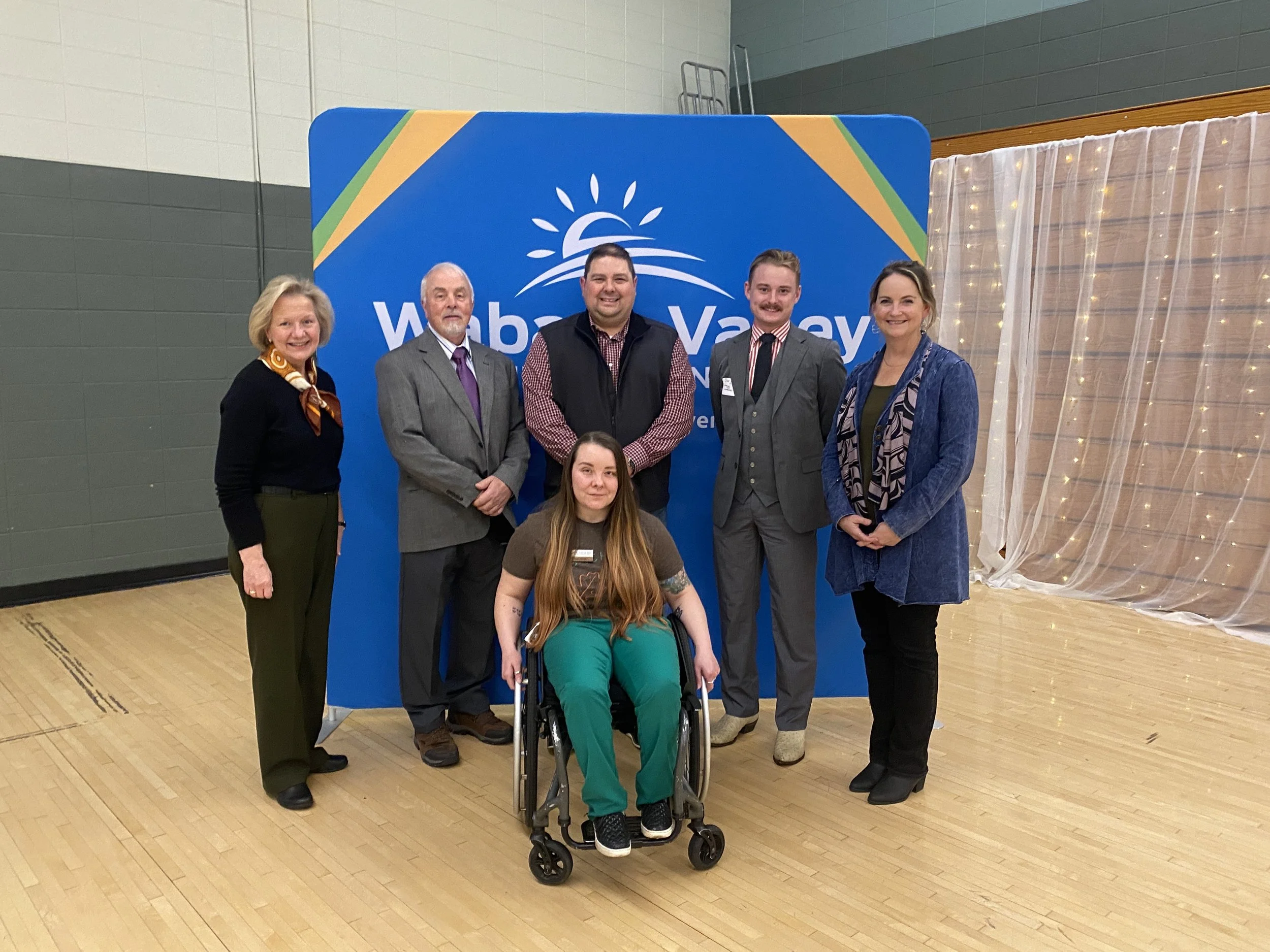
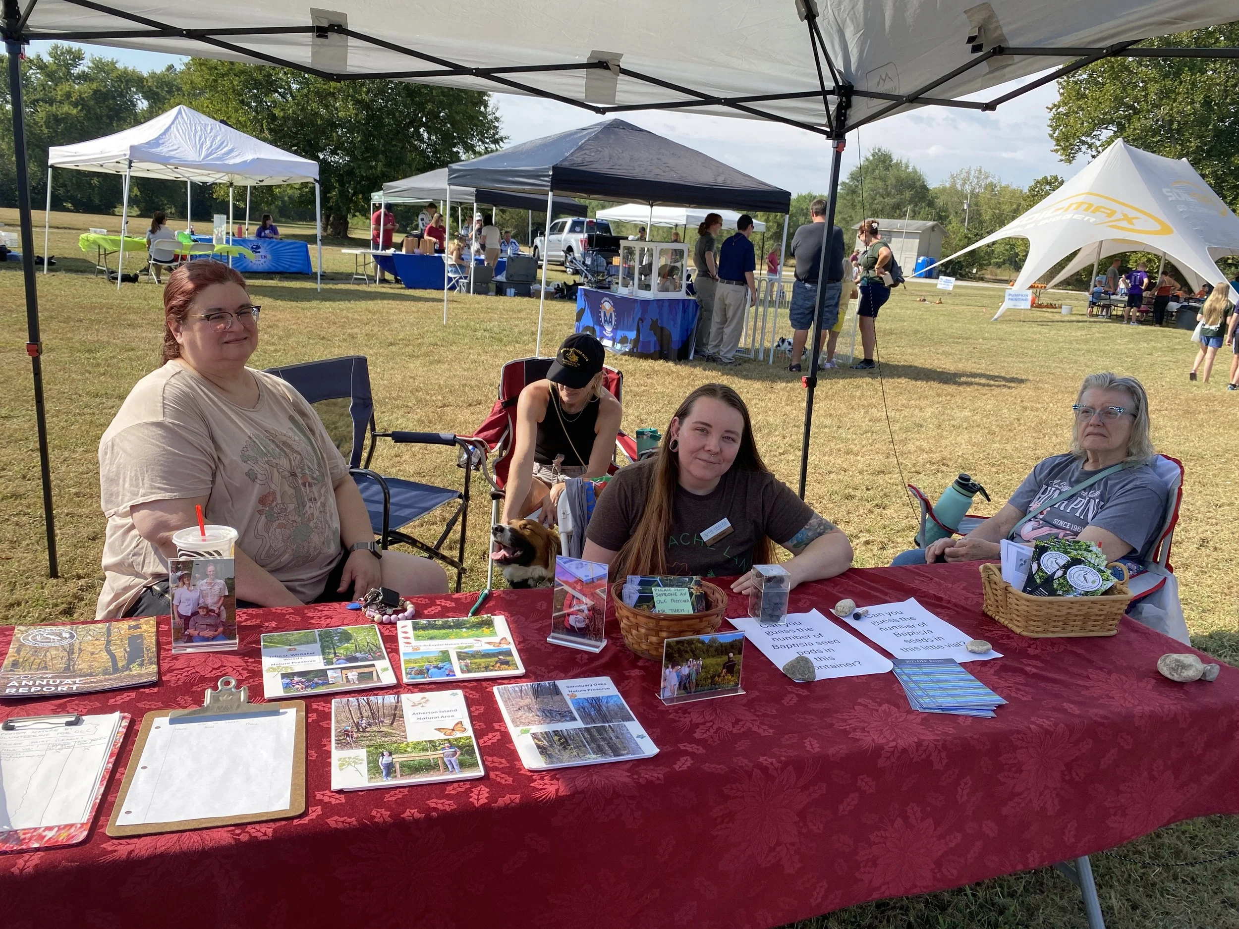
When Ouabache Land Conservancy (OLC) board member Marty Jones first heard about the Motus Wildlife Tracking System, he didn’t know much about it. Now, he's helping to lead an effort that will connect west-central Indiana to a cutting-edge international research network, introduce new scientific opportunities to the Wabash Valley, and enhance community engagement in conservation.

The plan? Install a Motus Tower at Atherton Island Natural Area, a special place near the Wabash River, an important but currently unmonitored migration corridor for birds, bats, and even butterflies.

“I didn’t know anything about Motus when this first came up. But it quickly became clear this would be a big deal not just for tracking birds and wildlife, but for building new partnerships and bringing attention to the importance of habitat in our region,” Jones said. 

What is a Motus Tower?

Motus (Latin for "movement") is a global network of automated radio telemetry stations that detect radio signals from tiny transmitters affixed to migratory wildlife. Indiana’s State Ornithologist Alli Gillet describes it as “a community of partners working together to better understand wildlife movement.”

Each tag emits a unique series of signals, like Morse code, on dedicated radio frequencies. Motus Towers, whether mobile handheld units or fixed stations like the one planned for Atherton Island Natural Area are constantly “listening” for those signals. When a tagged animal flies within range up to 9 miles in either direction the tower records the detection, contributing to migration and habitat data across the Americas.

“It’s really a selfless contribution. Putting up just one tower helps support dozens of research projects across the continent,” said Gillet.

Why Atherton Island Natural Area Matters

Atherton Island Natural Area is more than a pretty spot near the Wabash River–it’s a critical gap in the existing Motus map. The nearest towers are in Lafayette, Bloomington, and across the state line in Illinois.

“Right now, our stretch of the Wabash is a blank spot. But birds and bats use river corridors like this one as navigational routes. Adding a tower here fills a major hole in the data and connects us to a much larger story,” Jones explained.

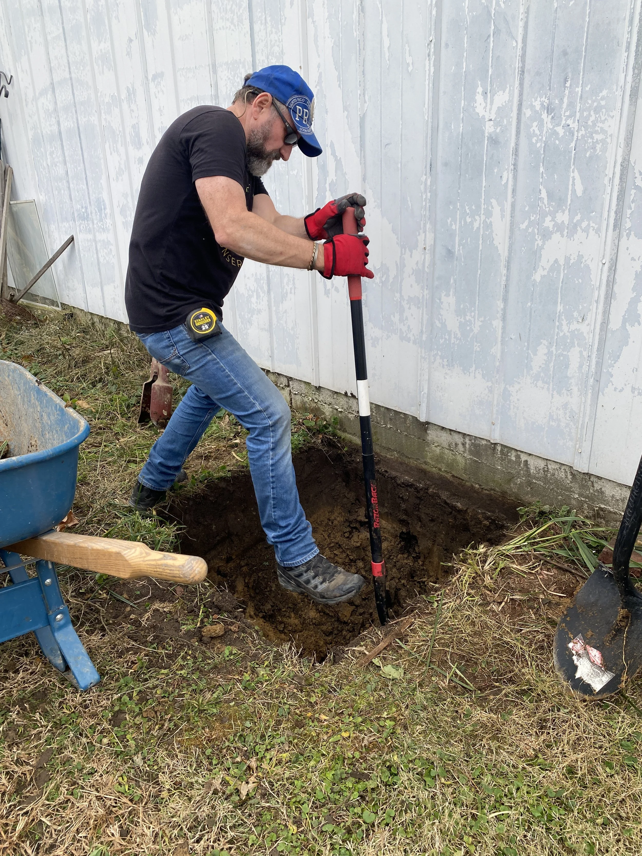
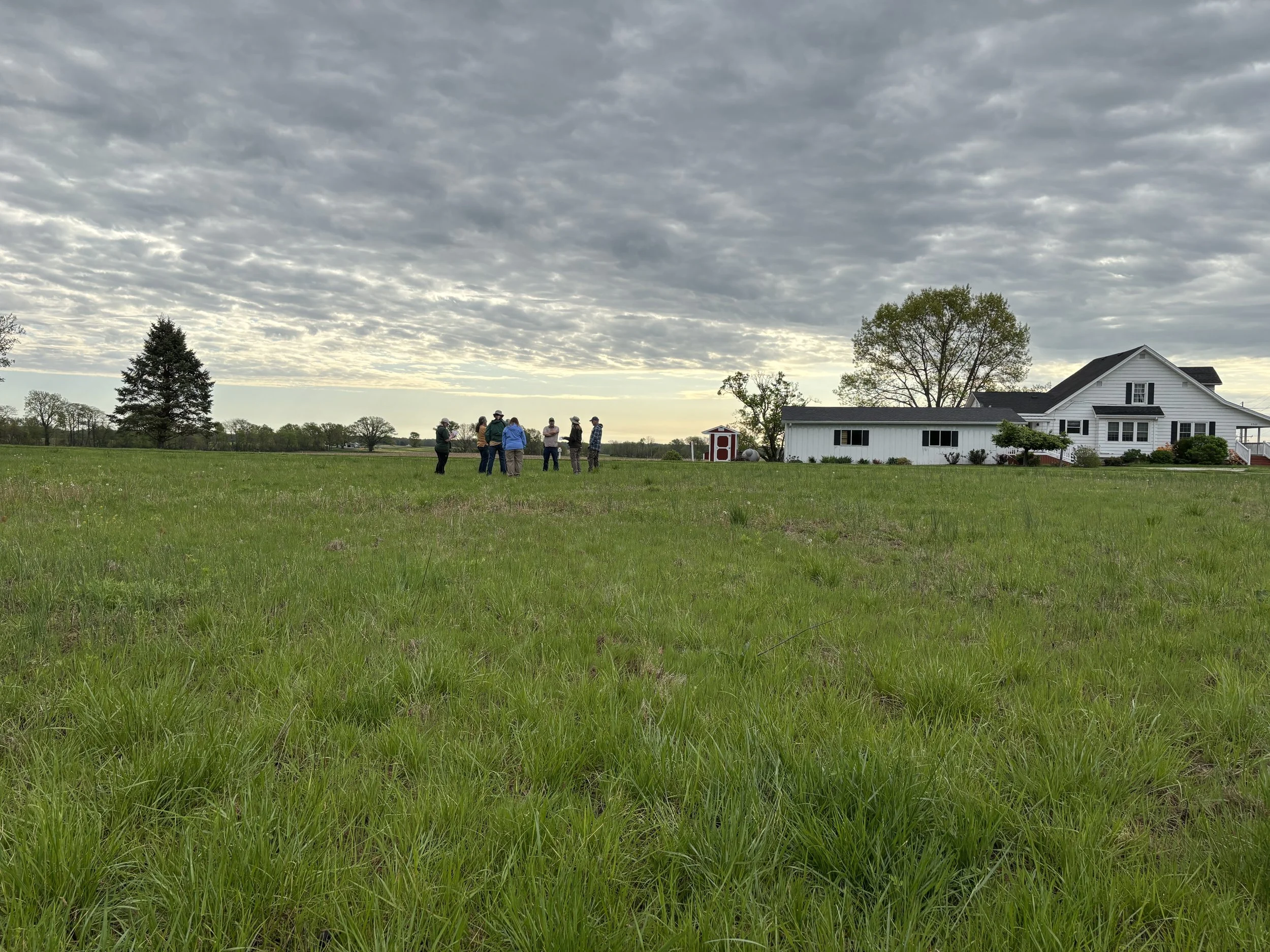
Atherton Island is also well-positioned for logistical success. After exploring multiple sites, the OLC team settled on a location behind a house. The site offers internet access and electricity, two essential components for real-time data transmission.

“It made sense in every way. It’s discreet, secure, and close to someone who cares deeply about the work we do,” Jones explained.

Building Partnerships for Conservation

The Motus Tower effort began with a conversation between Marty and Allen Pursell of the Sam Shine Foundation, a key conservation partner helping expand Indiana’s Motus presence. That conversation quickly evolved into action, with the Foundation helping support the project, granting OLC the flexibility to move at a thoughtful, sustainable pace.

Marty also reached out to a host of collaborators from the American Bird Conservancy, including Todd Alleger, Atlantic Flyway Motus Coordinator, to a new graduate student at Indiana State University, Jackson Kinder M.S. Biology, Avian Ecology, who is eager to join the effort.

“These types of relationships are what make a project like this possible. It’s not just about the hardware. It’s about building community with funders, researchers, and the public,” Jones explained.

Gillet echoes that sentiment, highlighting how the Motus network is both science-forward and community-driven. “You can actually go online and see which animals were detected by any Motus tower. That kind of public-facing data makes this project accessible and exciting,” Gillet explained.

A Tool for Research, Education and Inspiration

Beyond contributing to global research, the Atherton Island Natural Area Motus Tower will open doors for local science and education initiatives. With help from groups like the Wabash Valley Audubon Society, OLC hopes to engage in bird-tagging efforts and citizen science programs, allowing local residents to see firsthand how their region fits into a larger ecological web.

“We’ve tracked a bat from Mammoth Cave in Kentucky to Greene County, Indiana, and on to Lafayette. We’ve recorded warblers from Jamaica. This tower will help us understand where these animals go—and why,” Gillet shared.

Jones envisions educational signage near the site explaining the tower’s purpose, making the otherwise-invisible science more tangible to visitors. And if all goes according to plan, the tower will be operational by spring 2026, just in time for the next round of migration.

Making it Happen

Towers like this still come with significant costs ranging from $7,000 to $15,000, depending on the structure and components involved. Inflation and supply chain issues have driven up prices for antennas and electronic parts, most of which are sourced internationally. Ideal towers host eight directional antennas, coaxial cabling, a processing unit, a mast or mounting system, and access to power and the internet.

But the investment is worth it. As Gillet puts it: “What we’re studying now becomes the foundation of what we’ll teach, manage, and protect in the future. This is how conservation moves forward.”

A Tower that Connects Us All

At its core, the Motus Tower project is about much more than tracking birds; it's about building bridges: between science and community, data and action, people and the places they cherish.

“This project isn’t just for OLC. It’s a contribution to a larger scientific effort. But it also gives us a new way to engage our community. People love birds. They love learning how our land connects to something bigger,” Jones explained.

In an ever-changing world, that kind of connection may be exactly what we all need.

Want to help OLC bring this tower to life?
Support the Motus Tower project at: ouabachelandconservancy.org/donate.

Plant Inventory at Atherton Island Natural Area

Meet Rich Hull, a PhD candidate in the Ecology, Evolution, and Behavior program at Indiana University, who recently spent the day at Atherton Island Natural Area identifying plant species as part of his research.

Rich specializes in floristics, the study of plants within a region, and focuses on how plant distributions in the Wabash River region of Indiana have changed over time. His work links shifts in plant populations to human-driven influences like land use and climate change.

During his visit, Rich explored the AINA’s rich biodiversity and helped us deepen our understanding of this special landscape. We’re thrilled to have researchers like Rich contributing to the knowledge and conservation of our local natural areas.

Stay tuned as we continue to uncover and protect the wild beauty of places like Atherton Island!

Noteworthy Insect Visitors at OLC's Moth Night Out

On Saturday, July 26, 2025, the Ouabache Land Conservancy hosted an enchanting evening on the prairie for Moth Night Out at Atherton Island Natural Area in southwestern Parke County. The free, family-friendly event drew about 50 nature lovers of all ages eager to celebrate National Moth Week and experience the wonders of the night.

The evening began at 8:30 p.m. with a gentle walk through the prairie, where participants explored what was in bloom and learned how these flowers support native pollinators. As the sun dipped below the horizon, the prairie’s summer colors faded into twilight, making way for the night’s main attractions.

Around 9:15 p.m., guests gathered for a captivating owl program presented by Providence Wildlife Rehabilitation, featuring an Eastern Screech Owl. Thanks to the Wabash Valley Audubon Society, attendees were able to see raptors up close and hear about their unique adaptations and roles in the ecosystem.

Once darkness fully settled in, black lights illuminated sheets set up across the prairie, attracting a dazzling array of moths, beetles, antlions, and other nocturnal insects. Guests marveled at the variety of patterns, colors, and behaviors while learning about the vital role moths play as pollinators. Conversations also touched on which native plants can be grown to support moths and other nighttime pollinators.

The night held even more discoveries. A bat detector picked up the activity of these aerial insect hunters overhead, and in the quiet shadows, glowing patches of “foxfire” — bioluminescent fungi — lit up portions of the forest floor. Moth Night Out proved to be a delightful blend of science, adventure, and community connection under the stars.

ILPA's State of the Lands 2025 Report is here!

The annual State of the Lands publication from Indiana Land Protection Alliance (ILPA) is a collection of stories from the past year highlighting the impact of land conservation across Indiana.

It celebrates the work of Indiana land trusts to connect us across the state, communities, and generations. OLC is a proud member of ILPA, and this report highlights the grand opening of Atherton Island Natural Area in October 2024, a milestone made possible by the support of countless members, private donors, and other funders.

Read the report

Land Acquisition Training

Written by OLC board member Marty Jones

Last week, I had the opportunity to attend a training that allowed me to learn and meet other land conservation practitioners from around the country. The multi-day training, hosted by Land Trust Alliance, was called “Acquiring Land and Conservation Easements.”

Participants learned the elements of successful land acquisition, from the basics of real property law and transaction due diligence to project selection and strategic conservation planning. The event was held at the National Conservation Training Center in Shepherdstown, West Virginia, situated on a beautiful 500-acre campus alongside the Potomac River. The information gained will help support OLC in saving more of the land we all love.

Geology of Atherton Island Natural Area

Written by OLC Board Member Tom Zeller

The area around Atherton Island Natural Area has an interesting geologic history. Atherton Island is an upland immediately east of Clinton, Indiana.  It’s only about 300 feet above the surrounding area, but the edges rise quite noticeably from the floodplains on either side, of the Wabash River to the west and the much smaller Big Raccoon Creek to the east.  As the name suggests, it was once a literal island in the Wabash River, but of course is no longer. The “island” is about fifteen miles long, north to south, and is about five miles wide.  The feature is quite visible using Google Maps’ satellite view, as it is outlined by the roads on both sides that hug the flat terrain directly adjacent to the upland.

The Indiana Geological and Water Survey (IGWS) has determined that the Atherton Island Natural Area lies at the very southern limit of the most recent glacial episode, called the Wisconsin glaciation, which lasted from 50,000 to 10,000 years ago.  The Atherton area was covered by glacial ice, but, being at the edge of the glacier, by a much thinner covering than even a few miles to the north.

As the climate warmed and the glacial ice retreated from the area, large southward flows of meltwater surrounded Atherton Island, while Big Raccoon Creek fed into the eastern of the two large flows.  The eastern flow became blocked either by ice or by deposits of sand and gravel carried by the meltwater, causing a lake to form along the entire eastern edge of the island.  

Eventually the lake water rose high enough to spill back into the Wabash River on the north end of the island and the flow of water was reversed, as the lake emptied from south to north.  Now, the water of Big Raccoon Creek still flows north through the waterway initially formed by the southward-flowing post-glacial melt.

The deposits from the southward glacial flow and later lake environment partially filled the valley between Atherton Island the highland to the east.  After the stream flow reversal, Big Raccoon Creek carried much of these deposits away.  However, the highest parts of the previous valley fill were not removed by the much smaller flow of Big Raccoon Creek and still hug each side of its valley in features known as glacial terraces.  

A good place to see a terrace is the road north of Mecca, which is perched on the terrace material that the Creek did not scour away. The west side of the road faces the fairly vertical face of the Atherton upland.  To the east, the floodplain of the current Raccoon Creek is about 150 foot lower than the road. 

When the glacier first retreated, the land was barren and wind had a free hand in moving fine-grained silt, creating deposits tens of feet thick.  This material is called loess. Pronunciation of the term varies around the world, but in these parts, it’s pronounced “luss.”  Loess has the odd property of sticking together in a manner that allows steep slopes to form, even though one could easily scoop out the material with a spoon.  This makes it a popular location for birds nests, especially for swallows. 

The post-glacial wind also created a series of sand dunes which are still present as the sandy hills just east of Sandcut and west of Greencastle Road.

From a creek bed in the Atherton Island Natural Area, one can see the gray deposits left directly by the glacier.  While most stream and lake deposits are composed of material well sorted by size, depending on the energy in the environment at the time, these glacial deposits are a jumbled mix of silt, sand, and large pebbles.  Above this thirty-foot thick layer is a ten foot brown layer of the wind-deposited loess. 

Core drilling by the IGWS found glacial deposits made by the much earlier Illinoian glaciation (300,000 to 140,000 years ago). The older Illinoian deposits weathered into soil which was later covered by the Wisconsin glacier. 

For more information about the ice ages and Indiana, see https://igws.indiana.edu/Surficial/IceAge.

Be Tick Aware!


written by OLC board member Phil Cox

Many of us are starting to spend more time at Ouabache Land Conservancy preserves and other outdoor sites, thus increasing our exposure to tick bites and infection from some of the diseases they carry – especially Lyme disease. Taking some precautions to reduce risks of exposure and infection from ticks can make your outdoor activities safer and more enjoyable. Ticks can be found in almost any location that has animals and vegetation, so completely avoiding ticks is very difficult.

Even though June is the peak month for the tick that carries Lyme disease, the black-legged tick (aka deer tick), may bite whenever temperatures are above freezing.  Therefore, because the average high temperatures for Terre Haute are above freezing during the winter months, year-round vigilance is very important.  In fact, there were 13 known cases of human Lyme disease from December 2024 – February 2025 according to the Indiana Department of Health’s Tick-borne Disease Dashboard.  The total for Indiana in 2024 was 239 known human cases.  Twelve (12) of those cases were in the OLC service counties of Clay, Parke, Putnam, Sullivan, and Vigo. None were reported in Vermillion.

Here are some practices that will help prevent ticks from biting and passing disease organisms to you while traversing in potentially tick infested areas:

  • Wear light-colored clothing that makes it easier to see ticks and remove them before they get to bare skin.

  • Tuck in shirt-tails, tuck pants into boots or socks or use “tick gators” that are essentially a legging that covers where your pants and socks or boots meet or use good “old fashioned” duct tape.

  • Wearing a hat is another good precautionary measure.

  • Treat bare skin with repellants containing 20 to 30% DEET. Always read and follow label directions!

  • Treat clothing (not skin!) with repellants containing permethrin prior to entering areas with ticks. Once dried on the clothing, permethrin can still be effective after several washes (follow label directions).  If you are in tick-infested areas a lot, you may even want to invest in tick repellent clothing that can be bought online. Some companies even offer permethrin treatment laundering services to professionally treat clothing that you provide.

  • Upon your return, inspect clothing for any ticks. Tumbling clothes in a hot dryer for an hour will kill ticks. Shorter times may be effective if the clothes are not wet.  Don’t wash clothes first before drying, as ticks can survive being in the dryer when they are exposed to moisture first. 

  • Do a body check for any ticks and shower as soon as possible after visiting tick-infested areas.

If you find a tick attached, remove it by using tweezers or a tick removal tool to grasp it as near to the skin as possible and pulling straight out. DO NOT just grab it by the body and pull it off, because doing so may potentially squeeze the blood meal back to your bloodstream, potentially transmitting a disease to yourself.  DO NOT use hot match heads or needles, nail polish, gasoline or similar techniques to remove or smother the tick. Ticks that are removed shortly after they attach may not have the opportunity to pass disease organisms to you, so quick detection and removal are good prevention methods.  Once the tick is removed, wash the site with soap and water or rubbing alcohol.

You can submit a photo of the tick and get a free tick ID by a tick expert along with guidance on best next actions to lessen your risk of future tick bites and tickborne disease from the University of Rhode Island.  Their TickSpotters program provides users with accurate, timely tick identification information, as well as science-based risk assessments tailored to the tick that was photographed. For details, see: https://web.uri.edu/tickencounter

To get your tick tested for diseases, it can be sent to Ohio State University for $49.99.  For more info, see: https://buckeyeticktest.osu.edu   

If you experience a bull’s eye rash (Lyme disease) or other rash, headache, fever, fatigue, and muscle aches and pains or other unusual symptoms after a tick bite or exposure to tick-infested areas, see your physician immediately and they can usually prescribe an antibiotic.  And just because you don’t see a bull’s eye rash does not mean that you didn’t contract Lyme disease.  Skin reactions will vary. Some people break out in the classic bull's-eye rash associated with Lyme disease or the spotty pink rash that spreads from limbs to trunk associated with Rocky Mountain spotted fever (a disease transmitted via the American dog tick). But others show no such reaction. "Using a rash is not a good diagnostic," said Dr. Catherine Hill, head of Purdue Department of Entomology. "What's important to know is that if you've been out in tick habitat or you've got a tick bite and develop these symptoms within two to 10 days, you should see a doctor and seek immediate medical treatment."  Treatment is very, very important as Lyme disease can affect a person for their lifetime and most tick-borne diseases can be effectively treated with early detection.  

Don’t forget about taking precautions to protect your pets too!  According to the Companion Animal Parasite Council’s Lyme Disease monthly forecast, dogs in the OLC service area counties of Clay, Parke, Putnam, Sullivan, Vermillion, and Vigo are all at a high risk forecasted infection rate (from 6.86 – 10.62%) for Lyme disease -- except Vigo County is considered a moderate risk with a forecasted infection rate of 4.49% (https://petdiseasealerts.org/forecast-map/#/lyme-disease/dog/united-states/indiana). 

Even horses can get Lyme disease, as I know first-hand from last years’ experience with my family’s pony.  Daisy could not stand and could hardly move except to eat while lying down.  Luckily our veterinarian was able to diagnosis that she had a “hot case” of Lyme disease that we were able to treat, and she is now fully recovered.  I suggest that you establish a good relationship with your veterinarian to help combat Lyme disease for your pets.

There are several other ticks and tick-borne diseases to be aware of in Indiana, so below are some resources to check out.

Indiana Department of Health: https://www.in.gov/health/idepd/zoonotic-and-vectorborne-epidemiology-entomology/vector-borne-diseases/tick-borne-diseases  

Purdue University: https://extension.entm.purdue.edu/publichealth/insects/tick.html 

Center for Disease Control and Prevention: https://www.cdc.gov/ticks

Indiana Lyme Connect: https://indianalymeconnect.org 

In addition, Tim McDermott, Ohio State University Extension, presented the webinar: An Update on Ticks for 2025It was geared more toward Ohio, but is very relevant to Indiana too.  You can view the recording here: https://www.youtube.com/@EmeraldAshBorerUniversity 

I hope that you (and your pets) continue to safely enjoy the great outdoors, and remember to take precautions to reduce your risks of tick-borne diseases and see your physician immediately if you experience any symptoms.   

Have you seen fungi at an OLC nature preserve? What are they, and why do they matter?

written by OLC board members Tom Zeller and Jim Nardi

Climacodon shelf fungus with hundreds of Pleasing fungus beetles (Megalodacne sp.) photographed at Atherton Island Natural Area last September.

Fungi are easy to overlook.  They’re everywhere in the soil, but only when they “bloom” as a mushroom are we likely to notice them.  Yet they are critical for soil formation, as they break down plant cellulose, allowing bacteria to finish the decomposition of dead plants into organic-rich soil. And, it is only fungi that can break down lignin, the molecule that most plants use for structural strength.  

Moreover, 80-90 percent of all plants form a direct partnership with fungi.  The plants provide fungi with the sugars that the plants have manufactured from literally thin air using solar energy, and the fungi reward the plants with scarce mineral resources such as nitrogen and phosphorus.

To achieve this inter-species trading, fungi grow tiny hair-like projections, hyphae, that snuggle in between the cells in a plant’s roots. The membranes of fungal cells are in intimate contact with the membranes of root cells, and at this interface, nutrients are exchanged.

Coral fungus

Fungi also spread thin filaments of hyphae in the soil in search of minerals that will be traded with plants. Altogether, these filaments represent the largest portion of the living biomass in soil.

Since fungi are not photosynthetic, they rely on this trading network for their food supply. To keep their partners healthy, fungi encourage the growth of certain types of bacteria that protect the plants. Fungi also actively suppress plant root diseases by attacking plant pathogens with enzymes.

After mushrooms, the yeasts used in baking and brewing beer and the mold that grows on old bread, may be the fungi we’re most familiar with. Also, the lichens we see growing on trees and fallen logs are a combination of fungi working cooperatively with photosynthetic algae.

Fungi live for centuries, perhaps millennia.  One fungus in Michigan covers over 40 acres, weighs 11 tons, and is thought to be about 1,500 years old.

Chicken of the Woods fungus (Laetiporus sulphureus)

Experience Otter Creek Brings Environmental Education to Markle Mill Park

Last week, Ouabache Land Conservancy hosted Experience Otter Creek at Markle Mill Park in North Terre Haute.

Attendees of all ages explored the diverse ecosystem of the Otter Creek Watershed through engaging demonstrations and activities, including wildlife tracks, invasive species, beekeeping, and more. Captivating presentations by Providence Wildlife Rehabilitation featured Henrietta the red-tailed hawk and Stirling the great horned owl, and IDEM demonstrated fish identification with electrofishing.

In addition to educational exhibits, attendees enjoyed a bounce house, and many took home free trees provided by Ouabache Land Conservancy. The event was made possible by the support of several partners and sponsors, including Purdue Extension, Vigo County Soil and Water Conservation District, Terre Haute Parks & Recreation, IDEM, Vigo County Parks & Recreation, Wabash Valley Audubon Society, Indiana State University, and the Wabash River Heritage Corridor Commission.

The event brought community members together to learn about the wonders of the Otter Creek Watershed.

Best Visual Storytellers

Ouabache Land Conservancy took home the award Best Visual Storytellers at Tablescapes 2025! The theme, designed by board member Denise Marie Sobieski and advisory board member Diana Hews, was “Enjoying 4 Seasons of Land Protection.” Their design reflected wonderful aspects of natural areas throughout the year.

Indiana Land Protection Alliance (ILPA) Spring Gathering

Ouabache Land Conservancy board members joined land trust professionals from across the state at Fort Harrison State Park for the ILPA Spring Gathering. Attendees enjoyed a morning hike through the park’s scenic trails before coming together for lunch at the Reddick and Sycamore shelters. The afternoon featured engaging peer group discussions in Executive Leadership, Fundraising/Development, Stewardship, Outreach and Programs, and Marketing and Communications. It was a valuable day of connection, learning, and collaboration among Indiana’s conservation community. We are so grateful for the wonderful people in our land trust community who care about the land 🌳🌱 and each other.

Indiana Big Trees

Written by OLC Board Member Phil Cox

As I write this, spring is in full swing with the beauty of dogwood and redbud blossoms having left us in favor of the greenery of amazing photosynthesizing leaves.  We are lucky to live in a state that has a diverse array of 101 species of native trees.  These trees (and also non-natives) are greatly expounded on in 101 Trees of Indiana (Indiana University Press) by Dr. Marion T. Jackson — one of the founders of Ouabache Land Conservancy (OLC) and the Indiana Chapter of The Nature Conservancy.  As you visit OLC nature preserves, you are encouraged to admire the big trees and maybe even suggest some for consideration to be included in the Indiana Big Tree Register, as the Indiana Division of Forestry continues to update the register.

Here’s how it works — The Indiana Division of Forestry documents the largest known specimen of each native tree species in Indiana.  To qualify for the register, a tree requires three measurements: 1) trunk circumference, (in inches) at 4 1/2 feet above the ground. 2) total height (in feet). 3) average crown spread (in feet).  The total size of a tree is calculated using this formula: circumference + height + 1/4 average crown spread. The individual tree of each Indiana native tree species with the highest total points will be that tree species’ big tree champion. All nominations will be reviewed as received, but only the nominations with the highest scores will be verified.  Nominations for all tree species, as well as the following species that do not have a current champion are being accepted:  Umbrella Magnolia and Canada Plum.  

The tallest listed Indiana tree is a 152-ft. Bitternut Hickory growing in Hamilton County, the largest in circumference is a 361-in (9.58 ft. in diameter) Silver Maple in Lawrence County, and the widest crown is a 224-ft Blackjack Oak in Vanderburg County.  Vanderburg County can also lay claim to being the Big Tree Capitol of Indiana with 19 species of champions.  To review the updated Indiana Big Tree Register, view detailed measurement instructions and nominate a tree, see https://www.in.gov/dnr/forestry/forestry-publications-and-presentations/indiana-big-tree-register.

Unfortunately, of the 561 species in the 2021 National Register of Champion Trees, there are no Indiana trees listed.  The surrounding four states have at least two each, with Ohio leading the way with 16.  However, a small consolation for Kentucky and Illinois is that they hold bragging rights as co-champions to the largest Ohio Buckeye trees in the nation.  For more information about the National Register, see https://www.americanforests.org/champion-trees/champion-trees-registry.

Jim Nardi with an Ironwood tree that scored 127.75 points. The current record is 131.41.

In 2025, I encourage everyone to look for big trees.  If you discover a big tree, please consider measuring it and submitting the online form to be the next big tree champion.  Measuring trees is a fun activity for young and old alike, even if it doesn’t measure up to the registry trees.  Myself and Jim Nardi experienced this as we measured an Ironwood and Sassafras for bigness at Atherton Island Natural Area this spring.  Nothing ventured nothing gained was our motto!  If you need help with this process, please contact OLC at ouabachelandconsevancy@gmail.com.  In addition, if your big tree is in Vigo County, TREES Inc. keeps a registry for all of the species of largest trees there. For more information about their Big Tree Registry, see: https://www.treesinc.org/projects.  

Even if you don’t start looking for big trees right away, now is the time to be thinking about planting the next big tree champions for future generations.  Indiana landowners can order inexpensive, high-quality tree and shrub seedlings from the Indiana DNR Division of Forestry nurseries. These seedlings are 1-, 2- and 3-year-old bare-root seedlings intended for conservation plantings: windbreaks, wildlife habitat, reforestation, erosion control and other conservation uses in Indiana.  Trees are available in multiples of 50 or 100; or in packets containing a mixture of species for different planting purposes like nuts, fine hardwoods, upland or bottomland or wildlife plantings.  I suggest that you start planning now and order as soon as possible in October to get the species you prefer for planting next spring.  For detailed information refer to the Indiana Division of Forestry tree seedling nurseries website at https://www.in.gov/dnr/forestry/tree-seedling-nurseries or call the Vallonia State Nursery at 812-358-3621.

Phil Cox with a Sassafras tree that scored 231 points.  The current record is a tree with 273.02 points.